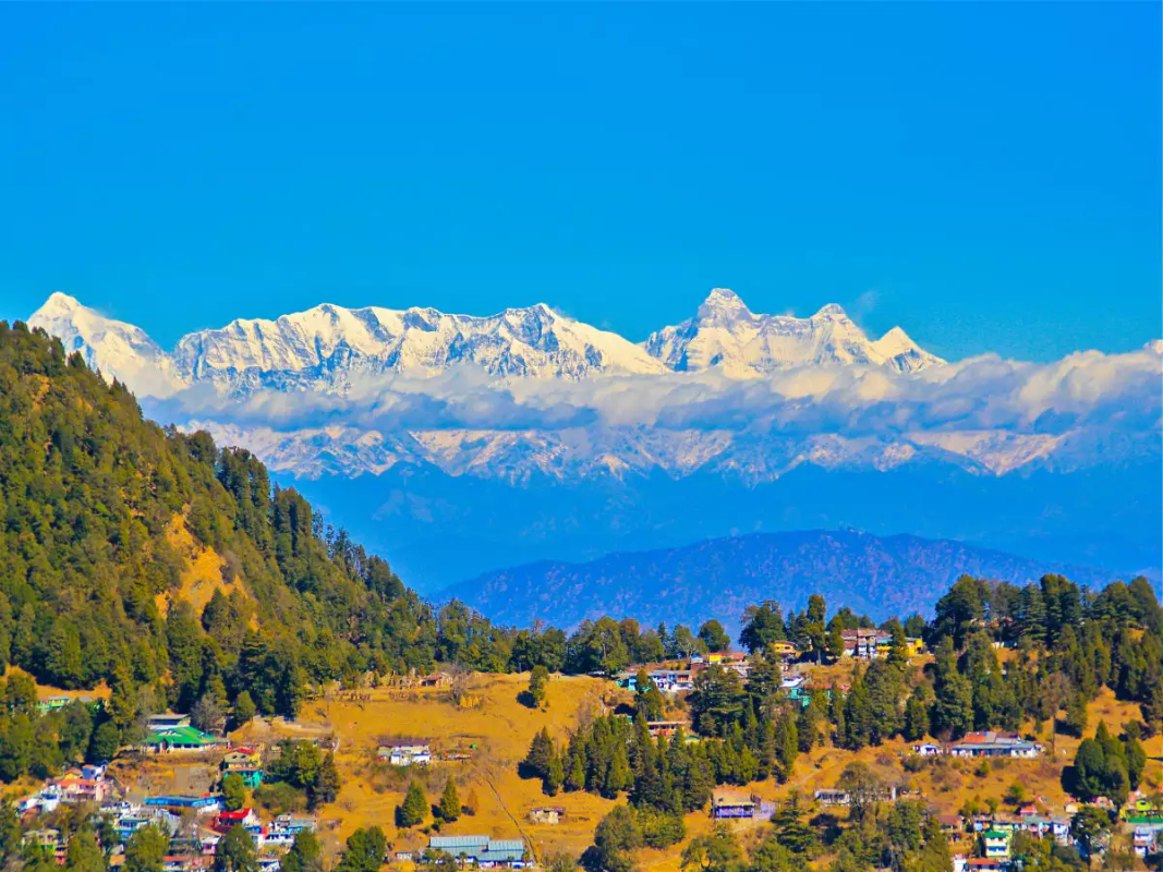
Uttarakhand is a part of the Western Himalayan ranges starting from the Shivalik foothills to Greater Himalayas with Tibet as its northeastern border. In the northwestern corner of the state is Himachal Pradesh, while Haryana celebrates its union with the newly formed state with a gentle kiss. The state is surrounded by Uttar Pradesh from most of its western and southern boundary. Apart from the Terai region in the Shivalik foothills, the entire state of Uttaranchal is a part of the Himalayan ranges. At 7,817 m above sea level, Nanda Devi in the district of Chamoli is the highest point in the state.
The region has many glaciers, passes, meadows, and trekking routes with several major rivers like the Ganga and Yamuna originating from here. A major part of this Himalayan state comes under rainforests and alpine forests that are home to some of the highly endangered wildlife species.
About Chamoli District
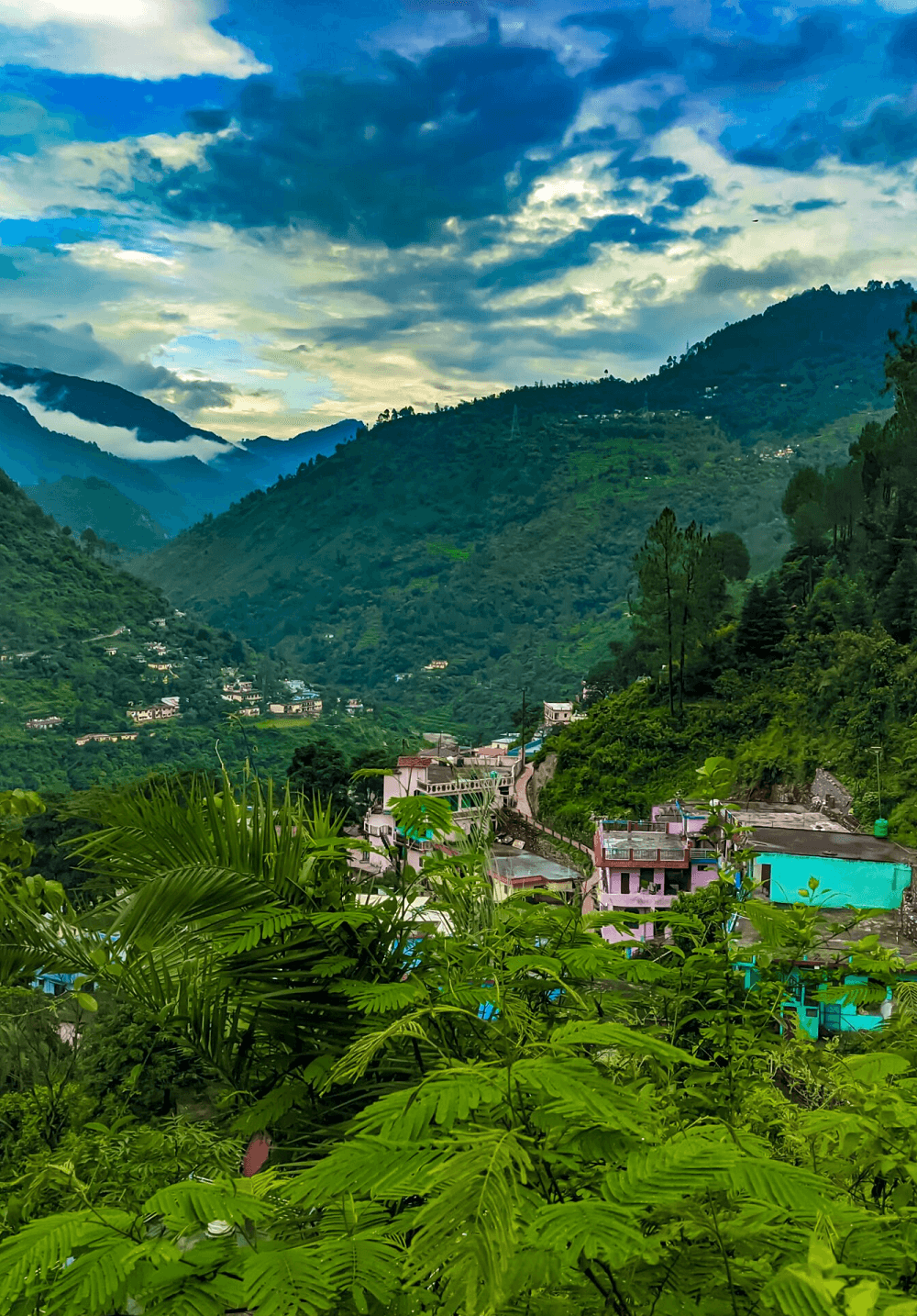
Nestled in the mountain ranges of the Himalaya, Chamoli is one of the main city of Uttarakhand and is the centre point of char Dham yatra. Chamoli District is the pride of Uttarakhand studding with major pilgrimage centre of the country like Badrinath, Joshimath and Hemkund Sahib, Snow-Clad Himalayan peaks and phenomenon natural sceneries. The District is said to be able to captivate any visitor with its mystic charm and pristine beauty. The lush green hills are a real paradise for trekking, climbing and hiking. Little quaint villages scattered around, International Border with Tibet and climatic cardinalties fulfills the journey with enthusiasm and lovable memories.
Chamoli district is the largest district of Uttarakhand state of India. It is bounded by the Tibet region to the north, and by the Uttarakhand districts of Pithoragarh and Bageshwar to the east, Almora to the south, PauriGarhwal to the southwest, Rudraprayag to the west, and Uttarkashi to the northwest. The administrative headquarters of the district is Gopeshwar.
Chamoli hosts a variety of destinations of pilgrim and tourist interest. Badrinath, Hemkund Sahib, Valley of Flowers and Auli. Chamoli also happened to be a birthplace of “Chipko movement”. Chamoli proved itself “the most spectacular in its natural assets; be it scenery, valley aspects, water-edges, floristic varieties, dramatic landform or the climatic cardinalities”. The district is also inhabited by Bhotiya ethnic group who adhere to Hinduism
The Project is situated at Joshimath Auli Road, Joshimath is a city and municipal board in the Chamoli District in the Indian state of Uttarakhand.
Distant From Resourt:-
Nearest Airport
:
Jolly Grant, Dehradoon Dist : 270 KM
Nearest Railway Station
:
Rishikesh Dist : 255 KM
Nearest Bus Stop
:
Joshi Math Dist : 2 KM
District Boundaries and other Statistical details:-
District Headquarter
:
Gopeshwar
Area
:
7951 SQKM
Total Population
:
App. 4,00,000
Literacy Rate
:
76%
Altitude
:
1300 M
Language
:
Kumauni, Garhwali, Hindi, English
Best Season
:
Throughout the year
The district is situated in the north-west corner of the state.
It is bounded on the north and to some distance in the north-west by the district of Uttarkashi,
In the east by the district TehriGarhwal and Pauri-Garhwal
In the south by the district of Dehradun ,
At its southern tip touching the boundary of district Haridwar
Best Paces to Visit In & Around Joshimath
1. Joshimath
Joshimath, also called Jyotirmath, is a hill region located at an elevation of more than six thousand feet in Chamoli. Joshimath is a pious region for Hindu devotees and is in close proximity to the four seats established by Adi Guru Shri Shankaracharya during the 8th century. This ‘math’ primarily concentrates on the Atharva Veda. It is a gateway to several Himalayan mountain climbing expeditions, trekking trails, and pilgrim centers like Badrinath.
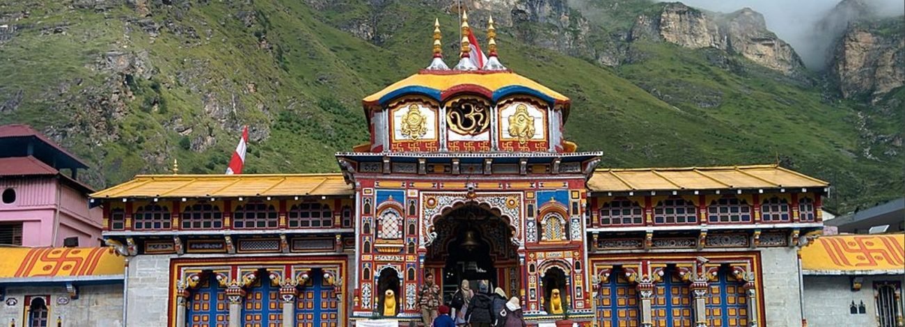
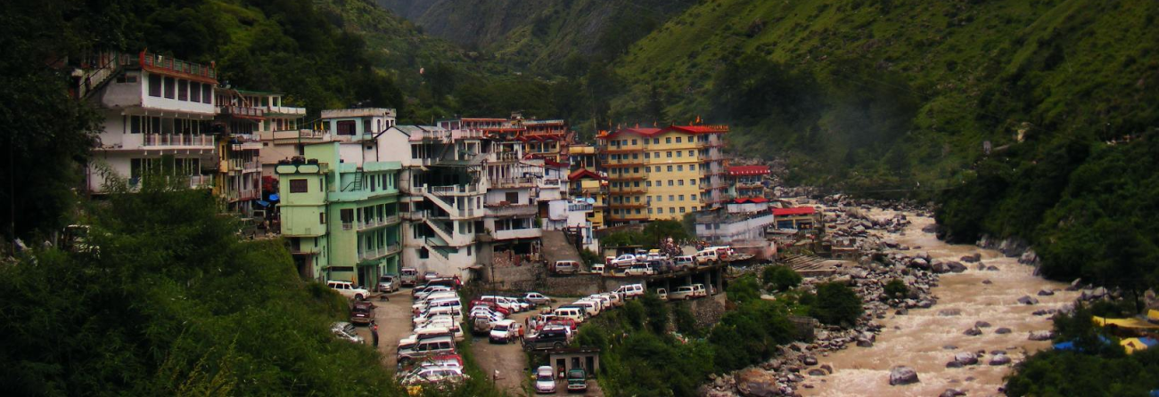
2. Badrinath Temple ( 45 k.m )
Badrinath, one of the most important pilgrim center of the country is a part of sacred CharDham” of the state, it is flanked by nar and Narayan mountains, while the neilkanth peak forms a splendid backdrop.
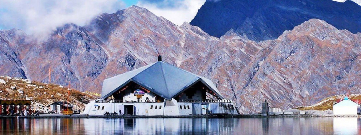
3. Hemkund Sahib ( 13 km By Road after 19 km Track )
Hemkund or the “Snow Lake” nestles at a height of 4329 MTRs amidst 7 snow covered mountains, which are collectively called hemkundparvat.
4. Govind Ghat (15 kms)
It is set on the confluence of the alaknanda and bhyundar or laxman ganga. There is a big gurudwara here.
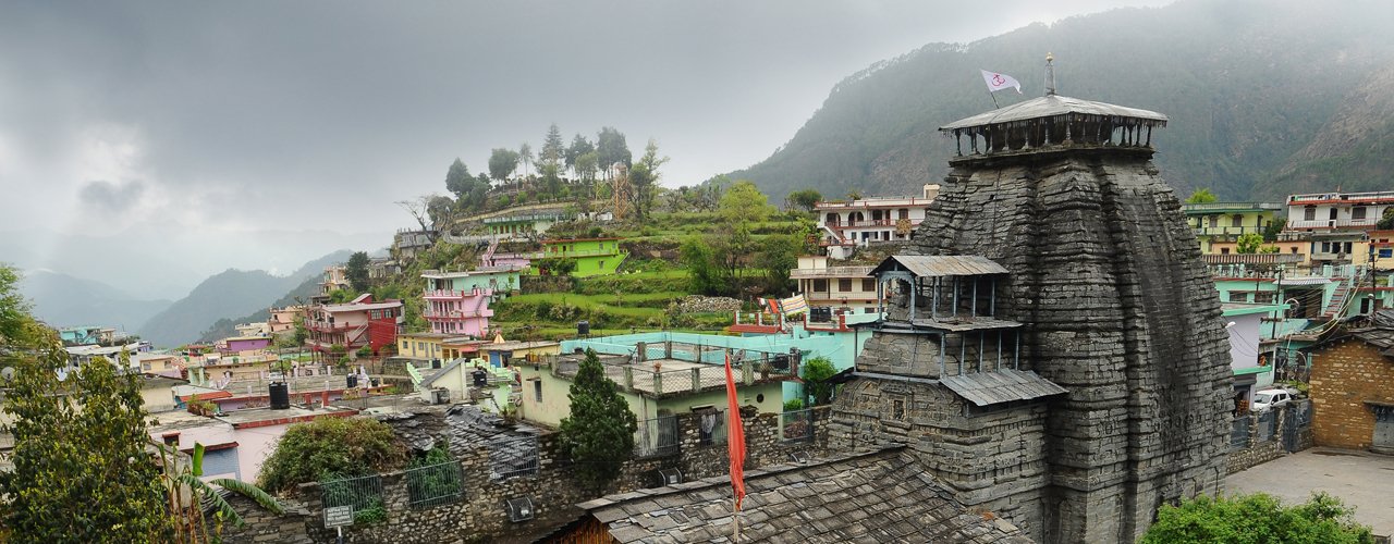
5. Gopeshwar
The picturesque town of gopeshwar has some good temple in and around the city. The main attractions are the ancient temples of lord shiva, vaitarnikund, a group of temples without idols and Oak View, etc.
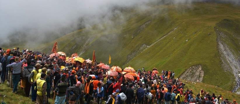
6. Nanda Devi Raj Jatyatra
Internationally renowned festival is held after 12 years and the celebration keeps on for 3 weeks.It’s a 280 km trek starting from Nauti Village (Karnaprayag) to the Peaks of Hemkund or Roopkund.
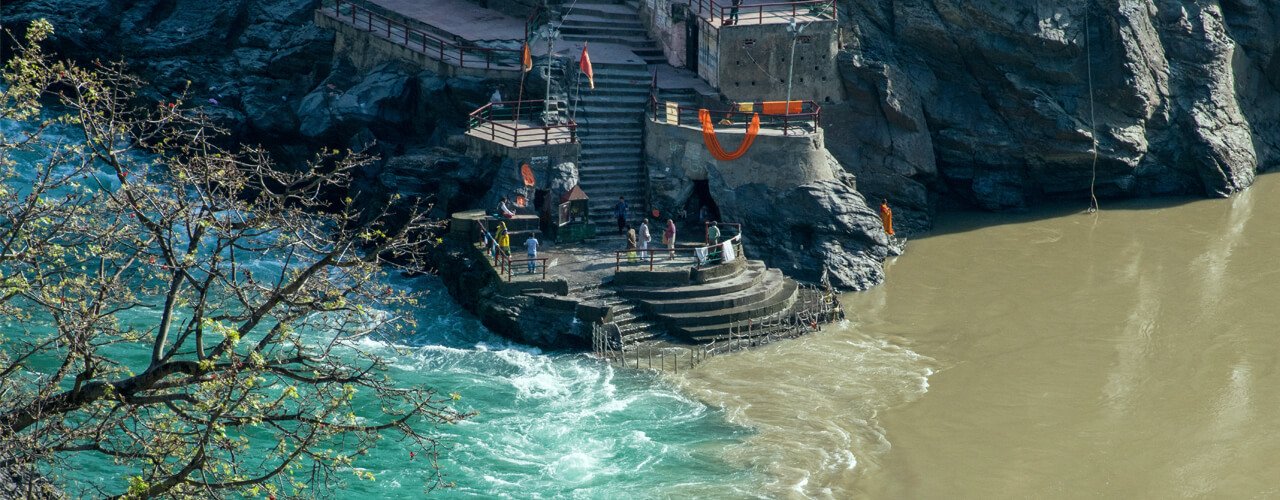
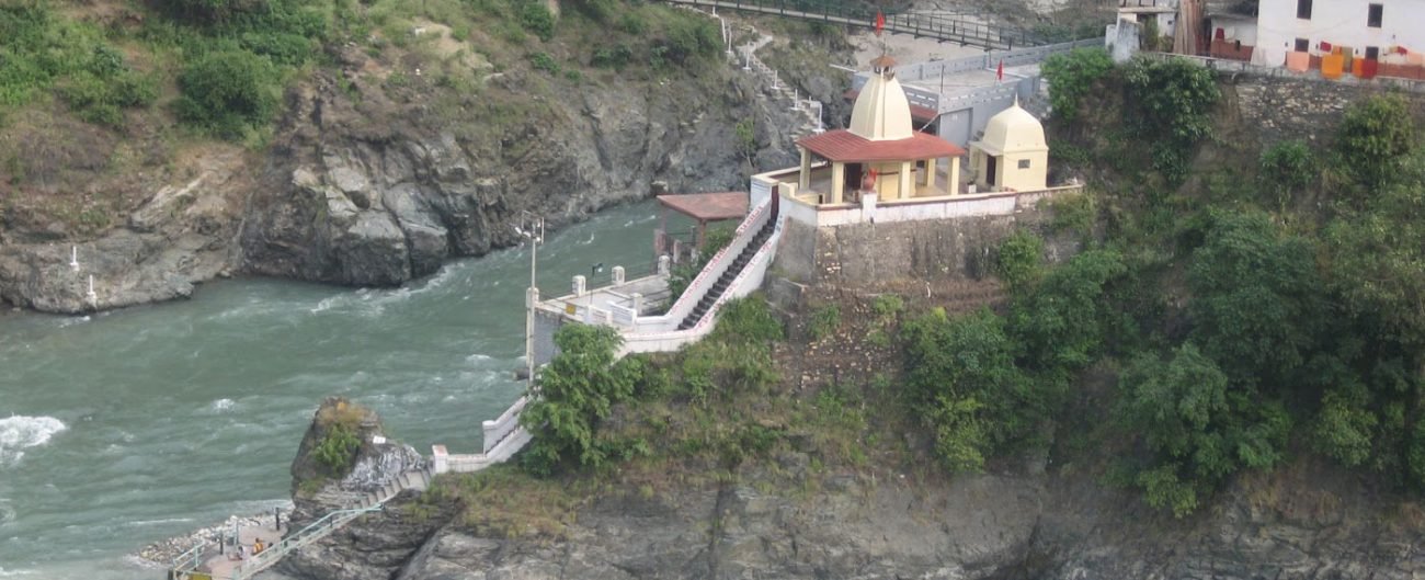
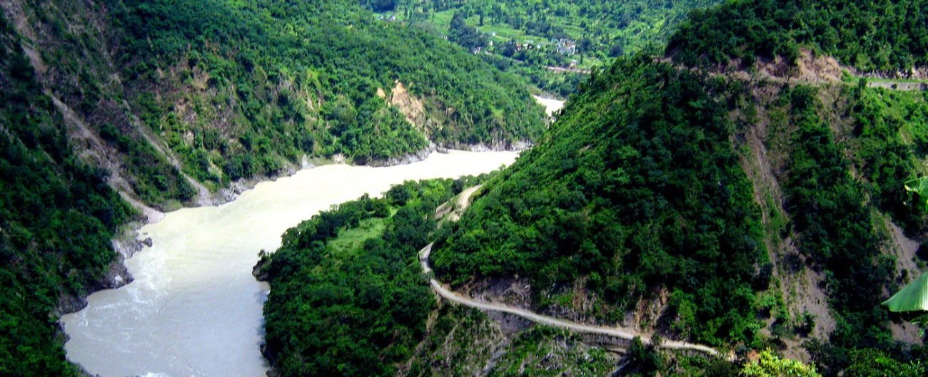
7. The Panchprayag
Panchprayag or the five most sacred river confluences/Garhwal Himalayas are of immense religious importance. The five Prayags are Vishnu Prayag, Nand Prayag, KarnPrayag, RudraPrayag and DevPrayag, of which 3 are in Chamoli District.
8. Nand Prayag
It is the confluence of Alkananda and Mandakni River, about 21kms from Kranprayag on the main route of Badrinath. The famous Gopal Ji Temple is situated here. Nandprayag hosts fair on the occasion of Baisakhi and Janmasthami.
9. Karna Prayag
It is situated on the Sacred Confluence of Alaknanda and Pidaari Rivers and is known for the Karna Temple and the Uma Devi Temple. It is believed that Lord Surya gifted Kavacch, Kundal, and Tuneer to Karna at Karnaprayag.
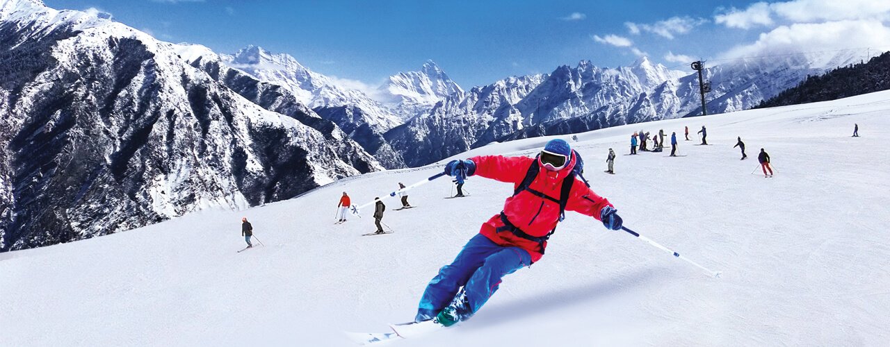
10. Auli ( 15 k.m )
This world class winter games resort is 16kms from Joshimath. The 3 kms long slop ranging from a height of 2519mtrs to 3049 mtrs is a major attraction.
11. Valley of Flowers ( 13 k.m By Road after 16 k.m Track )
This “Paradise” of Nature lovers was discovered by Frank Smythealongwith R.L. Holdsworth in the1930s.It lies 6kms from Bhyundar Village and covers an area of 87.5 kms, exceptionally rich in floral wealth